You Care About the Subdivision Regulations, You Just Don't Know It (Yet)
Everybody’s heard of the zoning code. Sooner or later, a developer will submit an application to rezone land near your home or business, and everyone snaps to attention. Neighborhood advocates awaken from hibernation. Developers lawyer up. Because these proposals can be controversial, they frequently make the local news. As a result, the zoning code has become the Kim Kardashian of land regulations. Even if you can’t really explain what it does, you know it exists.
But zoning disputes typically only involve a few parcels of land at a time. So if you really care about the future of your city, you need to think bigger. You need to be thinking about the regulating documents that influence the design of entire neighborhoods. One of the most important? The local subdivision regulations.
Despite their power to shape cities, these regulations operate in almost complete obscurity. Even the most battle-hardened veteran of the zoning wars would be hard pressed to explain what the subdivision regulations do. Most folks don’t even know they exist.
Be a Nerd, Save your City.
Basically, local subdivision regulations govern the division of land, which includes everything from a simple lot split to the creation of new neighborhoods from pastureland. Among other things, they establish rules for the creation of lots, blocks and streets, and provide for the establishment of easements, parks, and public rights-of-way.
Making modest, intelligent changes to this document can have enormous impacts because new neighborhoods tend to be mass-produced at a large scale. If your city hasn’t re-evaluated its subdivision regulations in a while, you’re probably still replicating bad ideas from the 1970’s — creating inflexible, and auto-centric places. If this is the case, it's time for a change.

At least one of these is fun. When subdivision regulations don't require connected streets, it's hard to get from place to place.
I know what you're thinking. As a Strong Towns member, I know the suburban experiment is a failed model and we need to stop. I'm also a realist, who recognizes how hard it is to turn an oil tanker. Change takes time. Consider these recommendations a baby step.
It's also important to remember that subdivision regulations apply to more than just Levittown-like housing developments. In many cities, there are opportunities for rezoning under-utilized land, such as large, unused industrial sites near city centers. When this land is developed, it should be platted in a way that accommodates walking and biking. So subdivision regulations matter, even to the sprawl-averse.
The “First and Last Mile” Shouldn’t Suck.
Whenever a new subdivision is built, private developers determine the layout of the neighborhood. They draw up the lots and blocks, and build the streets, utilities, and houses in accordance with the subdivision regulations and other applicable codes. Once complete, they sell the houses, convey ownership of the streets to the city and walk away.
Their goal is simple: to maximize profits, while meeting the minimum standards of the applicable regulations. They don’t have to worry about the long-term needs of an evolving city, or the flexibility or connectivity of a transportation system.

Example of a walkable neighborhood with short, connected blocks.
But we do. Because when the developer walks away, that street network becomes ours. If we don’t like it, we can’t re-gift it. We can’t donate it to Goodwill. We’re stuck with what they’ve built. And when neighborhoods are designed solely for cars, it doesn’t matter how many bike lanes and transit stops we build, because people are going to drive.
Maximum Block Lengths
When it comes to walkability, maximum block lengths can make or break a neighborhood. If your subdivision regulations haven’t been updated in a while, expect to see maximum block lengths of up to 1,500 feet or more. (For comparison, traditional neighborhood blocks are typically between 300-650 feet in length.)
Short blocks make it easy to get from place to place. Because you never have to travel out of your way, distances between destinations are shortened. The resulting compact street grid disperses and eases traffic by creating multiple options to get where you’re going. Traffic isn’t funneled onto a single street, and you never have to travel east to go west.

Long blocks and lack of connected streets drastically increase distances between destinations.
Short blocks are also flexible and capable of adaptation. Once a street network is built, it’s prohibitively expensive to acquire right-of-way and build new roads. But a compact street grid is nimble. It can easily handle more intensive uses and higher densities if, in the future, a city decides to rezone property to maximize the utilization of land.
Long blocks have the opposite effect. They’re incompatible with density because they can’t adequately disperse traffic. They decrease the number of potential routes, and increase travel distances between destinations. Long blocks also encourage drivers to speed, requiring cities to come back later to install speed humps and other traffic calming measures in an attempt to compensate for the original, flawed design.
So if you care about creating places for people who walk, bike and use transit, take a peek at your local subdivision regulations and see what they say about maximum block length. Requiring shorter blocks will help new neighborhoods support all modes of transportation.
Connectivity and Cul-de-sacs
Any time a street network looks like something your five-year-old scribbled on the wall with Crayons, it’s probably not a good place for walking and biking.
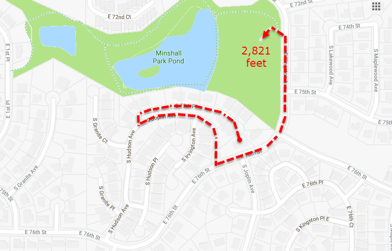
Just a simple walk to the park... Source: Google Maps
Unfortunately, traffic engineers have spent decades promoting a hierarchical system of streets where cul-de-sacs connect to residential collectors, which gather traffic before funneling it to arterial streets at limited points around the perimeter of a subdivision. This street design creates grossly inefficient travel routes, artificially concentrates traffic, and limits options for neighborhood entry and egress.
Sadly, many existing subdivision regulations still recommend cul-de-sacs and collector streets as a neighborhood ideal.
Around and Around we go. Literally.
When neighborhoods lack street connectivity, they induce auto-demand — increasing traffic, while making it less safe and desirable to walk and bike. It’s a vicious cycle. Artificially inflated travel distances make it impractical to walk or bike. With fewer people on the street, drivers feel comfortable speeding to make up for winding travel routes. And speeding cars make streets even less safe and desirable for cyclists and pedestrians.
Some would argue that disconnected streets are a harmless lifestyle choice. What’s the problem if some folks enjoy driving along curving, quasi-bucolic streets to nowhere? Well, as any Strong Towns member could tell you, places that don't utilize land to the fullest are wasting public tax dollars.
Consider the service area of a fire station. As an example, let’s look at how many households a given fire station can serve within a 2.5 mile drive.

Comparison of fire station service areas within a 2.5-mile drive. Service area maps created by Daniel Jeffries.
On the left is Fire Station #7, located in an older part of Tulsa, OK. The surrounding neighborhood is defined by a compact street grid, with short blocks and lots of connected streets. Within a 2.5-mile drive, the fire station can serve a land area of 12.61 square miles.
On the right is Fire Station # 27, located in a newer part of town. This area was developed under the modern, auto-centric subdivision regulations, which encouraged long blocks and cul-de-sacs. Street connectivity was not a top priority. Within a 2.5-mile drive, this fire station can only serve a land area of 10.77 square miles, which is approximately 17% less than the older neighborhood. When newer neighborhoods are comprised of widely dispersed single-family homes on large lots, the number of residents served by each fire station is even less.
Connectivity Counts
Make sure your subdivision regulations require connectivity within and among subdivisions. Streets, trails and sidewalks should connect to each other, and to adjacent public improvements and facilities such as parks, schools, and libraries. These connections are crucial for an effective transportation network — whether you’re a kid on a bike, or a resident in need of emergency services.
Some cities use a “connectivity index” to quantify the connectivity of a given neighborhood. Basically, you divide the number of street segments (links) by the number of intersections (nodes) to come up with a numeric value that represents the connectivity of a given area. A score of 1.4 is considered the minimum for a walkable neighborhood.

How to calculate a connectivity index. (Source: Victoria Transportation Policy Institute)
Dead-End Streets
Most subdivision regulations include a section devoted to “permanent dead-end streets.” If you care about connectivity and walkability, this is another section that deserves attention.
From a Strong Towns perspective, dead-end streets are little more than publicly maintained private driveways. As cities come to grips with their inability to maintain all the public infrastructure that’s been built, they will have to start prioritizing and making tough choices. At that point, some argue that cul-de-sacs will be the low-hanging fruit, an easy and obvious first choice for abandonment.
Developers, however, love cul-de-sacs because homebuyers perceive them to be safer places to live and are willing to pay a premium for homes at the end of the bulb. Sadly, cul-de-sacs are not necessarily safer. In fact, cul-de-sacs have proven to be dangerous places, especially for younger kids, due to the increased likelihood of being backed over by a vehicle when playing in the seemingly secure bulb of a cul-de-sac.
Weirdly, one of the main architects of modern cul-de-sac design is the International Fire Code. This regulation requires dead-end streets longer than 150 feet to include provisions for fire trucks to turn around. The most common method? A 96-foot diameter roundabout.

Mysteries of cul-de-sac street design explained. (Source: 2015 International Fire Code)
When dead-end streets exceed 500 feet in length, the Fire Code requires them to be 26-feet wide, rather than the standard width of 20 feet, making long dead-end streets 30% more expensive to build and maintain than normal, connected streets of the same length.
For these reasons alone, it probably makes sense to prohibit the use of dead-end streets whenever possible. In cases where dead-end streets are considered necessary, try to limit the maximum length to 150 feet or less.
Find Your Friends and Work Together
If you’re going to try to modify the subdivision regulations in your town, you’re going to need friends, because you’re sure to make enemies. (People who profit from the status quo sure hate change!)
Fortunately, a lot of folks care about the subdivision regulations — whether they realize it yet or not. So help them understand why it matters, and how they can be part of changing these regulations for the better.
Reach out to people who are passionate about walkability and good urban form. Public health advocates, accessibility champions, bicycle/pedestrian activists, school board members, PTA leaders, green builders, small-scale developers, and Strong Town members are all likely suspects.
Next, identify sections of the subdivision regulations that specifically impact walkability, and get everyone on the same page. Then, when you approach local leaders with your proposals, you’ll be in a stronger position to succeed. Good luck!
Sarah Kobos has been a regular contributor for Strong Towns since 2016. She is an urban design nerd and community activist from Tulsa, OK. Her superpower is the ability to transform almost any topic into a conversation about zoning. Whenever possible, she explores other cities and writes about urban design and land use issues at AccidentalUrbanist.com.